Bushfire and BAL Assessment
Locally Based, Local Contacts and Aligning Solutions to your Bushfire Problems
BAL Assessments; Bushfire Hazard Assessment (BHL); BAL Contour Plans; Bushfire Management Plans; & Asset Protection Zone and Bushfire Mitigation services.
Bio Diverse Solutions has over 20 years experience in Bushfire Management, we can assist clients with bushfire solutions tailored to the stage of development for your project.
Bushfire Planning
Bio Diverse Solutions has specialist bushfire consultants with the following accreditation in Bushfire Management:
- Level 1 BAL Assessors
- Level 2 Bushfire Practitioners;
- Work with Level 3 Bushfire Practitioners;
- Incident Control Systems;
- Operations Officer;
- Prescribed Burning Operations;
- Fire and Incident Operations;
- Wildfire Suppression 1, 2 & 3;
- Structural Modules – Hydrants and hoses, Introduction to Structural Fires, and Fire extinguishers; and
- Ground Controller.

Bio Diverse Solutions are a Silver Corporate member of Fire Protection Australia Association and Kathryn Kinnear is a committee member of the Western Australia Bushfire Working Group. Bio Diverse Solutions’ Bushfire Consultants develop Bushfire Management Plans, Bushfire Hazard Level, BAL Assessments and BAL Contour Plans to assist in resolving conflicts of new dwellings located adjacent to bushfire hazards.
Such planning takes into consideration standards and requirements specified in various documents such as:
- Australian Standard (AS) 3959-2018;
- Guidelines for Planning in Bushfire Prone Areas; and
- State Planning Policy 3.7.
Bio Diverse Solutions aligns all work to the latest applicable legislation, guiding subdivision design, safe location of buildings in bushfire prone areas and resolving problems/conflicts which meet the clients interest, the safety of future inhabitants and the approval of government agencies.
To find out if you are in a bushfire prone are and for more information on what being in a bushfire prone area means to you refer to our Useful links page
Bushfire Hazard Level (BHL) Plans
BHL Mapping Is the process applied at high strategic planning and structure planning stages whereby the defined WAPC methodology defines vegetation as Low, Moderate or Extreme Bushfire Hazard Level (BHL).
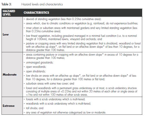
The process guides the developer to develop habitable buildings away from extreme bushfire risks and to design subdivisions in regard to bushfire protection criteria of location, siting and design, access and water.
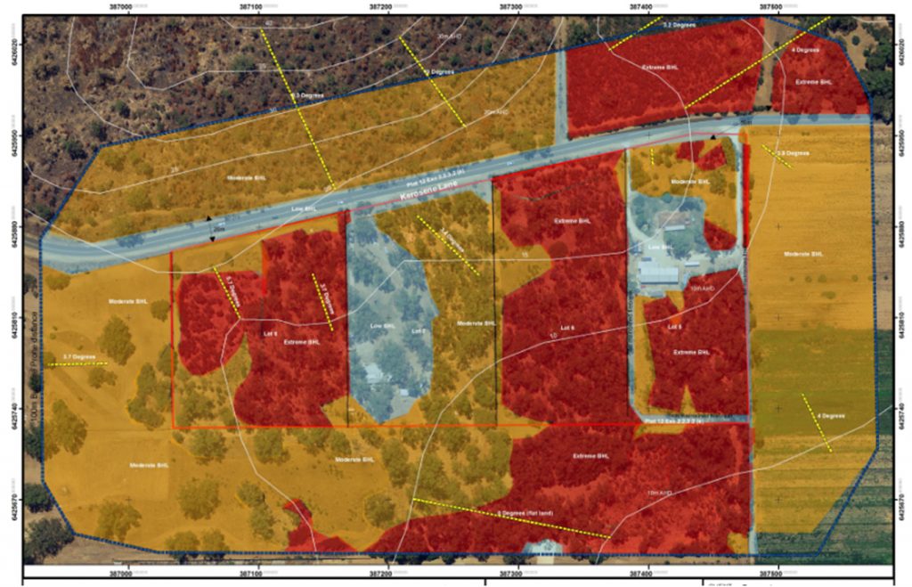
BHL Mapping is applied to:
- Subdivision planning
- Structure plans; and
- Development applications/approvals.
Our Services:
- BHL maps aligned to WAPC and DFES required methodology;
- Utilise latest aerial photography and GIS mapping to ensure accuracy and produce quality maps for future use;
- Identify any problems/conflicts with possible BHLs (Extreme and Moderate) allocation and work to resolve for the client while meeting budget/yield/cost constraints; and
- Give recommendations on the subdivision/ structure design to ensure compliance through the proceeding stages of planning.
Bushfire Management Plan (BMP)
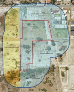
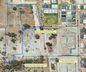
The basic requirements of any Bushfire Management Plan (BMP) is to identify potential issues or problems relating to environmental fire threats and recommend specific actions by certain persons, agencies, authorities and developers to ensure, as much as practical, that the lives and assets of the location are not put at undue threat from any unplanned bushfire event.
The Guidelines for Planning in Bushfire Prone Areas outlines bushfire protection criteria which subdivisions and development proposals are assessed for compliance. The bushfire protection criteria (Appendix 4, WAPC, 2015) are a performance based criteria utilised to assess bushfire risk management measures and they outline four elements, being:

- Element 1: Location;
- Element 2: Siting and Design of Development;
- Element 3: Vehicle Access; and
- Element 4: Water.
Our Services:
- Ensure the bushfire mitigation measures are practical and able to be implemented by the developer;
- Align all work to WAPC and DFES required methodology, state legislation and guidance notes;
- Undertake consultation with stakeholders (DFES, LGA, WAPC) to ensure timely approval process ensures;
- Utilise latest aerial photography and GIS mapping to ensure accuracy and quality maps for future use;
- Identify any problems/conflicts with BAL allocation and work to resolve for the client while meeting budget/yield/cost constraints; and
- Give recommendations on the subdivision/structure design to ensure compliance through the proceeding stages of planning.
Bushfire Attack Level (BAL) Assessments
In reference to the WA Bushfire Reforms released in 2015 Bio Diverse Solutions provides quality detailed BAL Assessments to various clients, tailored to their bushfire needs.
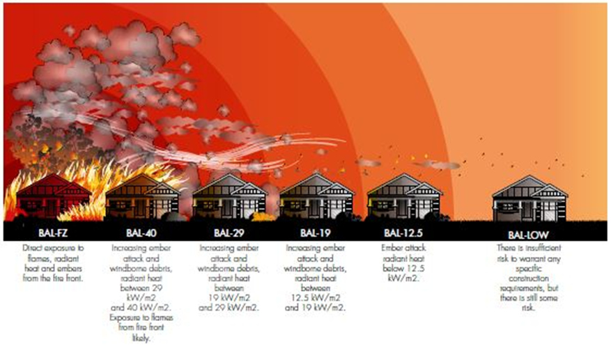
Bushfire Attack Level (BAL) is the determination of the construction requirements for a building site, with the threat or risk of bushfire attack assessed by a qualified Bushfire Consultant.
BAL rating determinations are of 6 levels BAL-LOW, BAL-12.5, BAL-19, BAL-29, BAL-40, BAL FZ. Building is generally not recommended in BAL-40 or BAL-FZ areas. The BAL rating is determined by the distance of the building to vegetation, slope and vegetation type adjacent to the dwelling.
Our Services:
- GIS Mapping;
- Field assessment to AS3959-2009;
- Prepare GIS mapping & report;
- Problem solving;
- Liaison and education to the owner of the property;
- BPAD certification/Accredited FPAA Assessors; and
- Provide a works program detailing how a client can achieve a lower BAL rating.
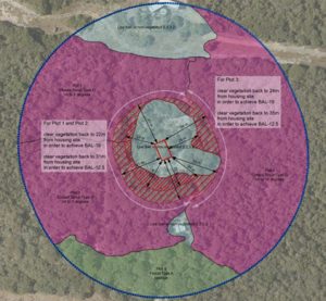
Bushfire Attack Level (BAL) Contour Plans
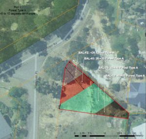
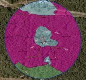
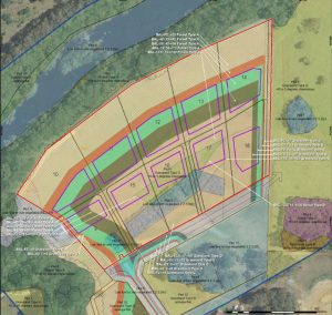
BAL Contour plans are scale maps illustrating the potential radiant heat impacts and associated indicative BAL ratings in a series of “Contours”. BAL Contour maps can guide the risk assessment process and are useful for:
- Problem solving house locations on individual lots;
- Plans of subdivision; and
- Strategic planning proposals.
The BAL Contour process includes any assessment of a subdivision proposal to the current Guidelines for Planning in Bushfire Prone Areas.
Our Services:
- Integration of AutoCAD drawings and GIS layers to assess radiant heat impacts and BAL allocation to proposed lots;
- Detailed assessment of bushfire impacts to 100m of the lot boundary;
- Briefly assess whether the proposal will meet the specified bushfire protection criteria as outlined in the guidelines;
- Prepare detailed report aligned to WAPC and DFES requirements and the methodology as outlined in AS3959-2009;
- Utilise latest aerial photography and GIS mapping to ensure accuracy and produce quality maps for future use; and
- Identify any problems/conflicts with BAL allocation and work to resolve for the client while meeting budget/yield/cost constraints.
Bio Diverse Solutions work to:
- Ensure the bushfire mitigation measures are practical and able to be implemented by the developer;
- Align all work to WAPC required methodology, state legislation and guidance notes;
- Undertake consultation with stakeholders (DFES, LGA, WAPC) to ensure timely approval process ensures;
- Utilise latest aerial photography and GIS mapping to ensure accuracy and produce quality maps for future use;
- Identify any problems/conflicts with possible BAL allocation and work to resolve for the client while meeting budget/yield/cost constraints.
- Give recommendations on the subdivision/structure design to ensure compliance through the proceeding stages of planning.
